


Trying to get to know ...
... the aul' country again

I have never been much of a walker but since I moved back to Northern Ireland, I started for a number of reasons.
Firstly, there are some amazing walks here; secondly, it’s a good way to get some exercise; thirdly it’s a good way to socialise; and fourthly (and most importantly) I want to get to know my own country again. Having left here in 1972 and visited lots of other parts of the world, I realised that I knew next to nothing about it. And what I did know, I’ve forgotten.
I must admit I haven’t been hugely successful with my efforts so far but I’ve taken a few steps (excuse the pun) in what I hope is the right direction.
The first issue to address was clothing. As they say, there’s no such thing as bad weather, just the wrong clothes. Being endlessly thrifty, I didn’t want to spend too much money so I decided to make do with a jacket that I’ve had for years, my existing trail shoes and some poles that I was given many years ago and which have been languishing in my umbrella stand ever since.
However, after a very wet and windy walk with the U3A one week, I realised that I really had to invest in a pair of those waterproof trousers. From a fashion perspective, they have nothing to recommend them but given the weather here, they are pretty essential.
As a way of getting started, I bought a second hand pair on Vinted. On the whole, it’s a great site as the stuff on there is very cheap but you can’t return an item if it doesn’t fit.
In this case, I admit that the advert emphasised the very narrow waist. There was even a picture showing how tiny it was. For some reason I decided to ignore the evidence of my own eyes and bought them anyway. Sadly, I could barely get them over my knees. In the end, I had to cut the waist in four different places. I can now just about get them on.
The next question was where to walk. So I bought myself a book called “Northern Ireland: The Unmissable Walks” as well as an Ordnance Survey map of the Glens of Antrim. I must admit I’m not sure I understand exactly how to use the map and I don’t think I’d set off on my own with it as my guide, but luckily the book cross refers to it and seems pretty easy to follow.
Unfortunately, the book doesn’t include a route to The Hidden Village of Galboly in the Glens of Antrim which is a pity because it’s high up my list of places to explore. I have to say that I wouldn’t have known about it if my old flame hadn’t mentioned it when he took me for a drive to where he used to go to boarding school in the wilds of the glens of Antrim. In case you didn’t read my previous blog post about this old boyfriend, we met up a few weeks ago after 45 years of not having any contact.
Anyway, back to the village - it’s so well hidden that even he had trouble locating it. But after we had driven up and down the coast road between Garron Point and Glenariff a few times, we realised that the only access was via a small (and unmarked) layby where walkers can start the climb. We didn’t attempt it that day as we didn’t have enough time and anyway, neither of us was wearing the right shoes.
However, I went back on my own a few weeks later, struggled again to find the layby but eventually succeeded. I parked the car and set off. It’s only about half a mile up a gravel path or so to the actual village which now consists of about 10 or 12 derelict cottages.
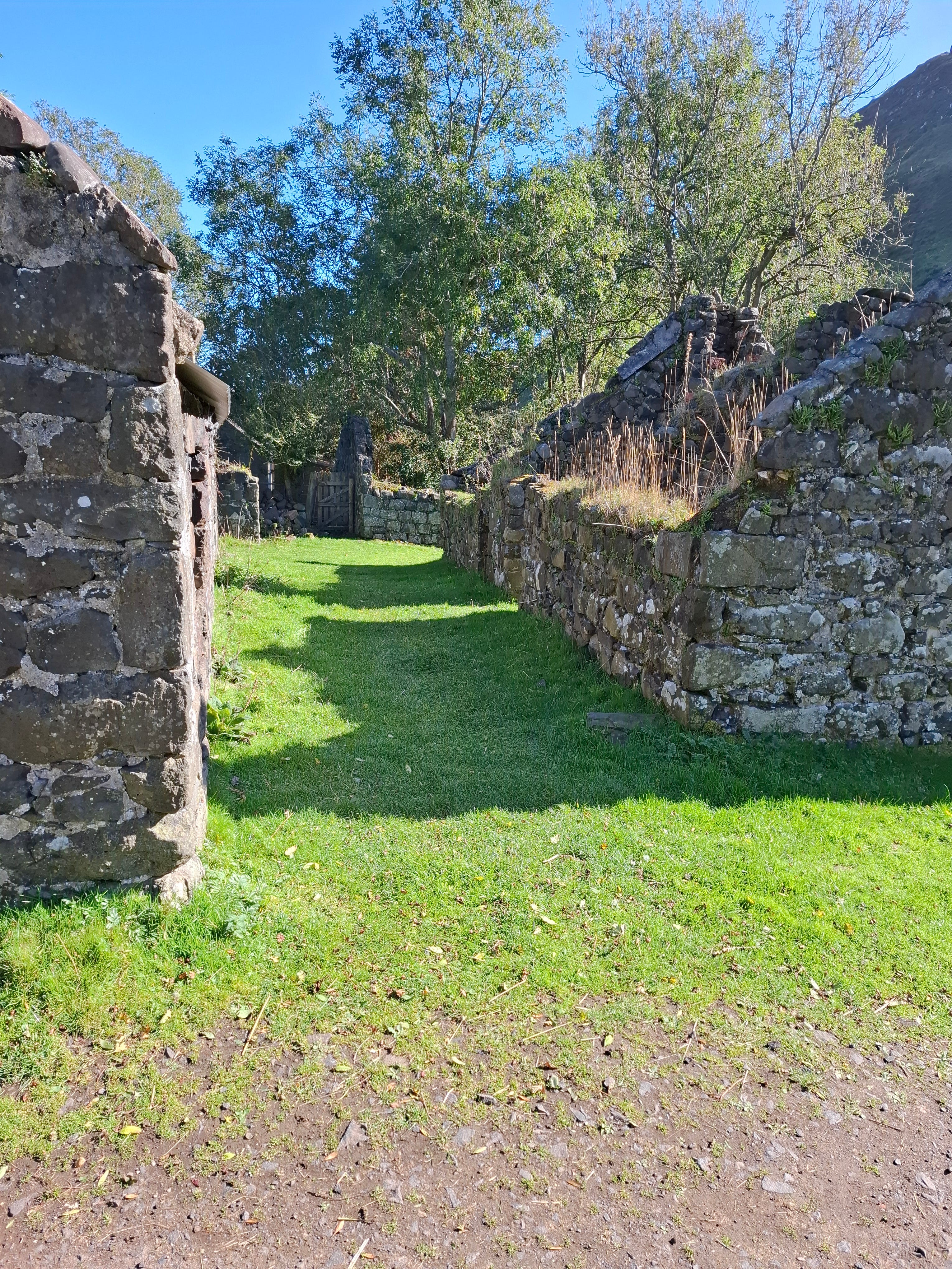
Although no one lives there anymore, the village had about 50 houses in the mid-19th century and was big enough to be divided into Lower and Upper Galboly. The inhabitants were mainly subsistence farmers who probably ate what they could grow and being near to the sea, they had a plentiful supply of fish and shellfish. The main drawback was that there was no water supply, so it had to be transported to the village by donkey.
As farming methods changed, the old way of life became unsustainable and by 1961, only a handful of people remained. The last resident was a monk called Veder who had originally been a resident at the nearby Portglenone Abbey. This is where things get weird because by a very strange coincidence, that last resident was none other than the brother of my old flame.
Like my friend, Veder attended boarding school nearby. Called Garron Tower, it was about an hour’s drive from where both boys lived in Coleraine. The reason they went there was because, as Catholics, they could not attend the grammar school in their hometown as it was for Protestants only at that point in time.
After leaving school, Veder became a monk and joined the brotherhood at the Abbey. According to my old flame, he asked for and was given permission to leave the Abbey in order to live in the village. Apart from visits from his family mainly to bring him food, he saw no one else.
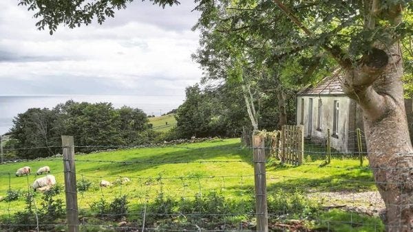
He lived in the cottage pictured below for many years without any electricity (so no heat or light) or running water. Despite the fact that it is absolutely in the middle of nowhere, he told his family that he was never lonely thanks to his faith and his passionate interest in nature. He lived there until 2013 when he died of cancer aged 73, the last resident of Galboly.
After another half mile or so, the path disappears and the terrain gets much steeper. To be honest, I can’t imagine how anyone lived up there as both the weather and the terrain are so unforgiving. The views over the north Atlantic are, however, truly spectacular.
I couldn’t help but wonder whether the people who farmed there would have been interested in the scenery or if they would have been so consumed with the struggle of staying alive that they didn’t have time to consider anything else.
Who knows? Maybe now and again they would have looked out at the rolling hills and the water with seven colours of blue and think how lucky they were to live there. Or maybe I’m just being ridiculously sentimental.
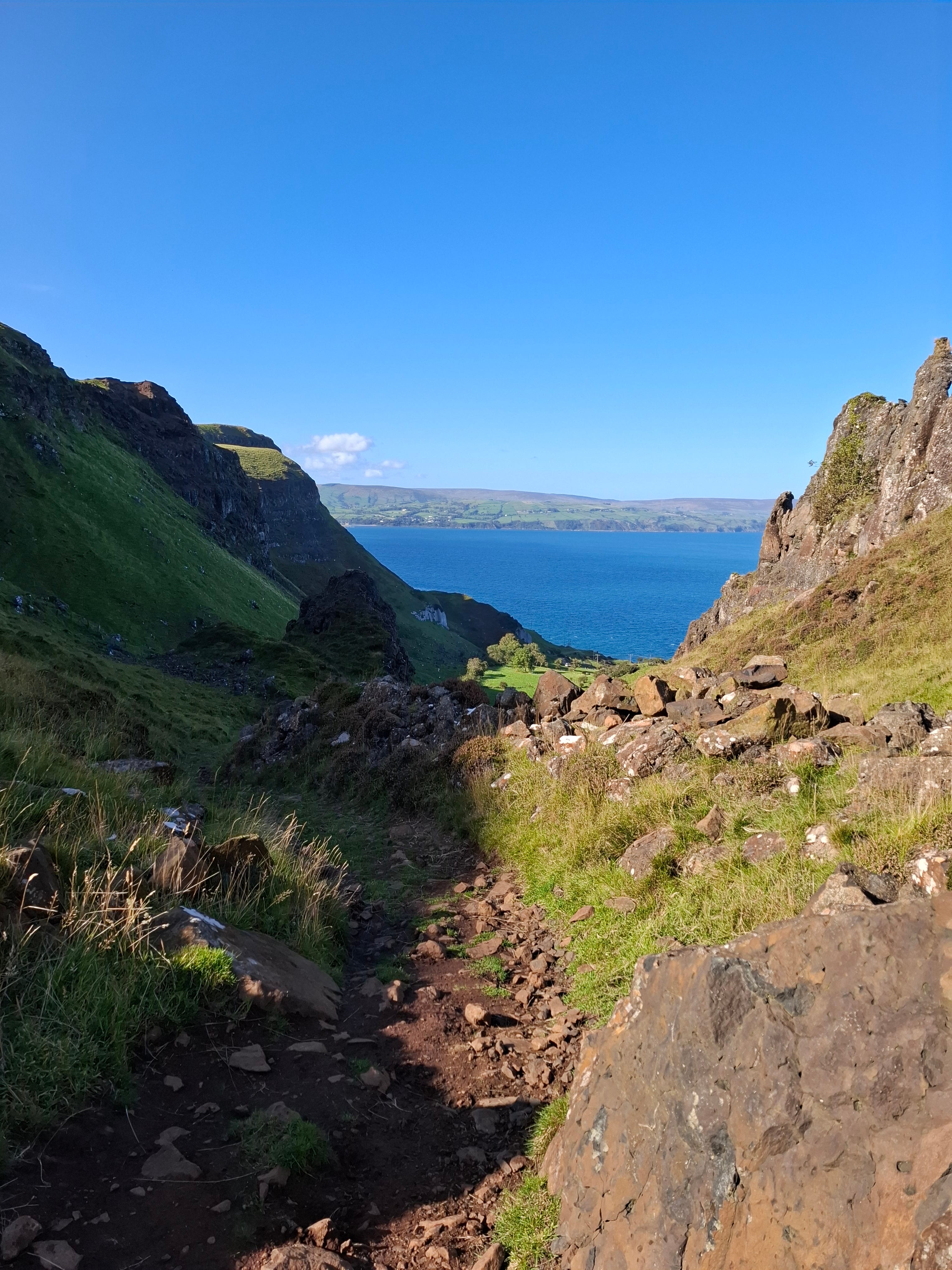
Whatever the truth, it’s a really stunning walk and I’m so glad that I found out about it. The aul’ country is genuinely beautiful to behold.
Really enjoyed this and interested in the place... plus the photos. Blue skies!